


Water Management
VerticalPoint RTK grade control
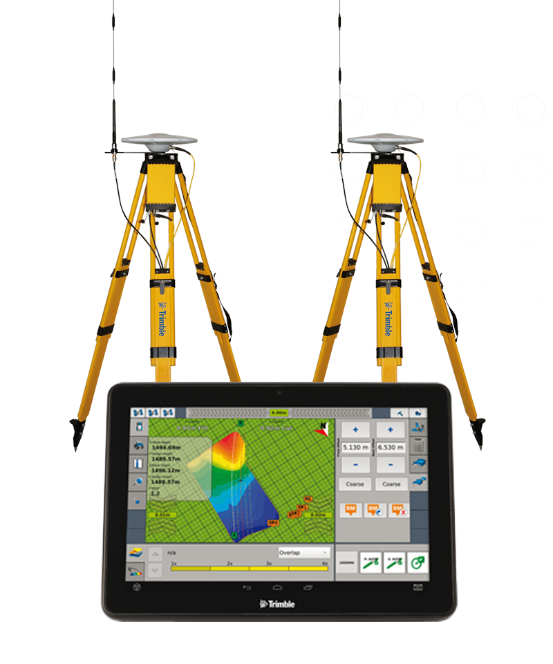
The VerticalPoint RTK™ grade control system facilitates the networking of multiple base stations in order to provide dynamic positioning to your equipment, helping achieve maximum vertical accuracy for all leveling and land forming operations.
Benefits and performance
Maximum vertical accuracy
VerticalPoint RTK provides access to live data collection, helping you efficiently maintain grade control over time for your leveling and land forming projects.
Increased productivity
Provides up to 95% uptime during continuous in-field operations and reduces drift caused by inconsistent vertical signals.

Product Summary
VerticalPoint RTK grade control
The VerticalPoint RTK™ grade control system facilitates the networking of multiple base stations in order to provide dynamic positioning to your equipment, helping achieve maximum vertical accuracy for all leveling and land forming operations.
Hardware/Software
Specifications
Networks multiple base stations in order to provide dynamic positioning to receivers on both the tractor and the scraper bucket
Can network up to four satellite rovers to optimize accuracy
Related Products
Connecting your farm
Are you looking to develop a comprehensive precision solution for your farming operation? Explore related products to add even more accuracy this season.

AgGPS 542 GNSS receiver
The AgGPS 542 GNSS receiver can serve as a GNSS rover system or base station and includes both “fixed base” and “mobile base” kits.
Note: This product is no longer in production, but is compatible with some current Trimble solutions.

FieldLevel II system

WM-Form design software
Have questions?
Trimble’s worldwide network of authorized resellers provides precision agriculture solutions,
insight and support at a local level.
Through well-known brands, including Fendt®, GSI®, Massey Ferguson®, Precision Planting®, PTx Trimble and Valtra®, AGCO Corporation delivers farmer-focused solutions to sustainably feed our world through a full line of tractors, combine harvesters, hay and forage equipment, seeding and tillage implements, connected precision farming solutions, grain storage and protein production systems, as well as replacement parts.
©2024 AGCO Corporation